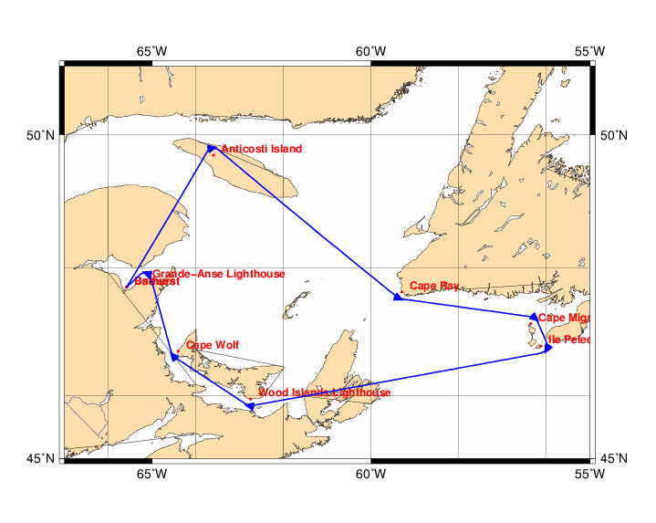
Chart and Info: Gulf of St Lawrence 2025 (951nm)
Start time: Apr 21 2025 17:00:00 UTC

Start by Bathurst at position: 47N42.3906 065W35.0932

Marks:

BRG is the bearing from ship to mark at scoring position.

 1: Anticosti Island        - Leave 49N42.0000 063W36.0000 to Starboard - BRG 169
 2: Cape Ray                - Leave 47N37.7100 059W17.9940 to Port      - BRG 025
 3: Cape Miguelon           - Leave 47N08.4348 056W21.2034 to Starboard - BRG 220
 4: Ile Pelee               - Leave 46N47.2104 056W07.5786 to Starboard - BRG 298
 5: Wood Islands Lighthouse - Leave 45N56.9688 062W45.3960 to Starboard - BRG 012
 6: Cape Wolf               - Leave 46N42.3942 064W24.7104 to Starboard - BRG 049
 7: Grande-Anse Lighthouse  - Leave 47N49.0800 065W10.9200 to Port      - BRG 201

Finish line:

Line by Bathurst between marks A and B at positions:

 A: 47N42.1596 065W34.9522
 B: 47N42.6216 065W35.2341