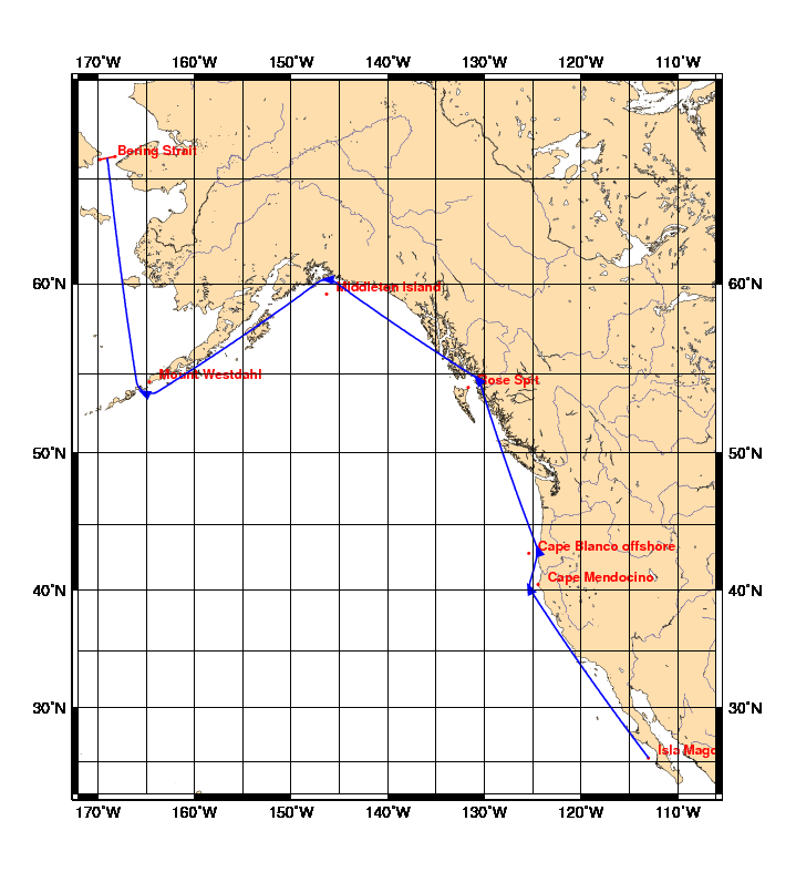
Chart and Info: Grey Whale Migration
Start time: Mar 13 2010 03:00:00 UTC

Start by Isla Magdalena at position: 25N22.5600 113W00.0000

Marks:

BRG is the bearing from ship to mark at scoring position.

 1: Cape Mendocino       - Leave 40N26.5020 124W24.7200 to Starboard - BRG 065
 2: Cape Blanco offshore - Leave 42N50.4000 125W24.0000 to Port      - BRG 251
 3: Rose Spit            - Leave 54N10.6740 131W38.9340 to Port      - BRG 231
 4: Middleton Island     - Leave 59N28.1400 146W18.7800 to Port      - BRG 183
 5: Mount Westdahl       - Leave 54N31.0700 164W39.1862 to Starboard - BRG 026

Finish line:

Line by Bering Strait between marks A and B at positions:

 A: 65N50.3269 169W47.8634
 B: 65N57.6731 168W12.0223