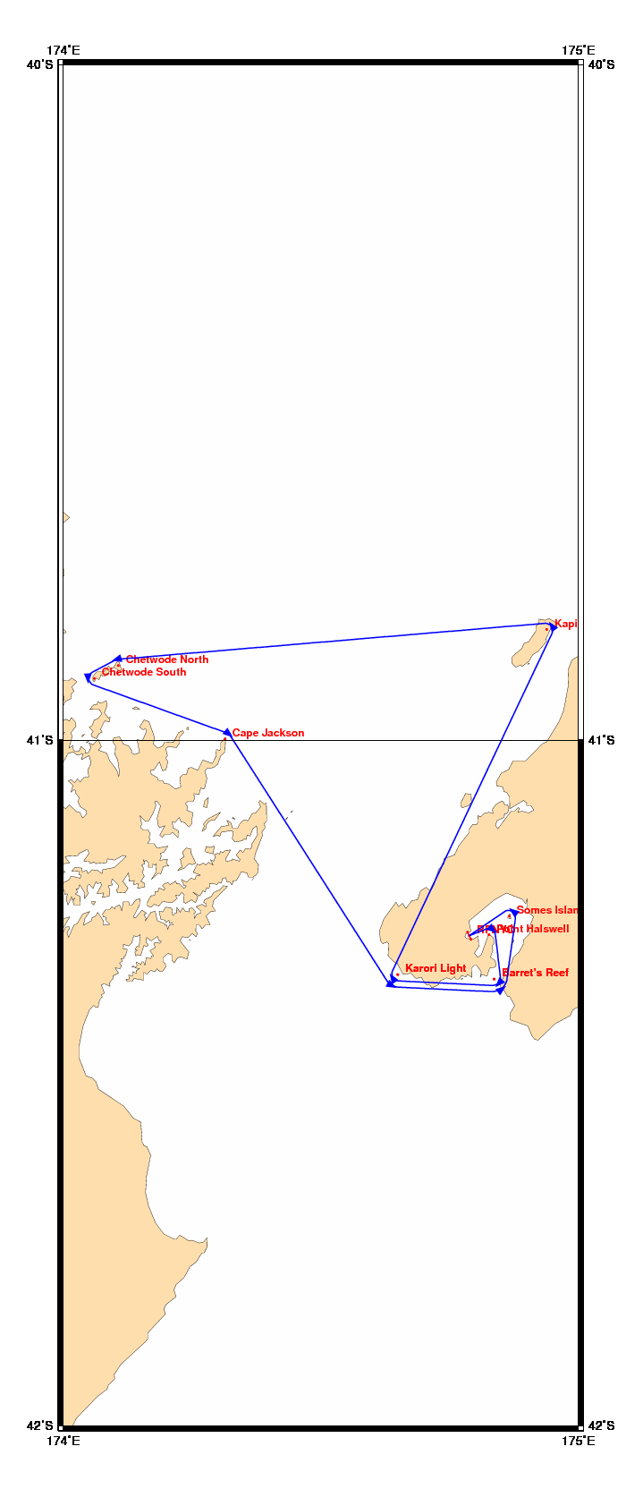
Chart and Info: Kapiti-Chetwodes (138nm)
Start time: Oct 02 2010 07:00:00 UTC

Start by RPNYC at position: 41S17.2230 174E47.2765

Marks:

BRG is the bearing from ship to mark at scoring position.

 1: Point Halswell - Leave 41S17.1300 174E49.5660 to Starboard - BRG 220
 2: Barret's Reef  - Leave 41S21.0310 174E50.1852 to Starboard - BRG 313
 3: Karori Light   - Leave 41S20.6347 174E38.9623 to Starboard - BRG 058
 4: Kapiti Island  - Leave 40S50.2500 174E56.3100 to Port      - BRG 234
 5: Chetwode North - Leave 40S53.4300 174E06.3960 to Port      - BRG 163
 6: Chetwode South - Leave 40S54.5700 174E03.5940 to Port      - BRG 088
 7: Cape Jackson   - Leave 40S59.9100 174E18.8160 to Starboard - BRG 219
 8: Karori Light   - Leave 41S20.6347 174E38.9623 to Port      - BRG 028
 9: Barret's Reef  - Leave 41S21.0310 174E50.1852 to Port      - BRG 323
10: Somes Island   - Leave 41S15.5100 174E51.9420 to Port      - BRG 218

Finish line:

Line by RPNYC between marks A and B at positions:

 A: 41S17.5376 174E47.4803
 B: 41S16.9084 174E47.0727