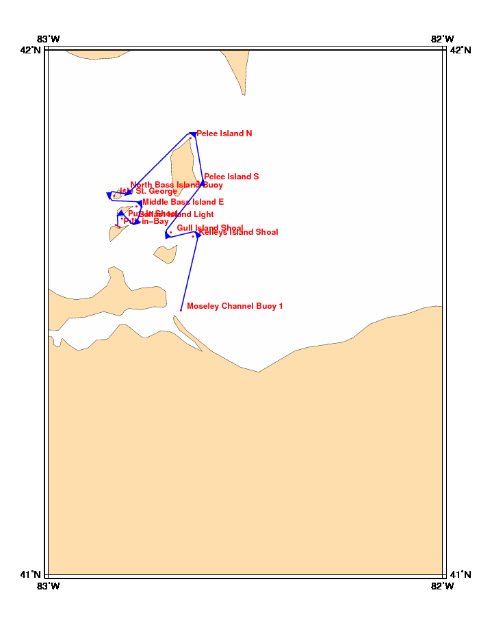
Chart and Info: Lake Erie Round the Islands Challenge (35nm)
Start time: Oct 03 2010 18:00:00 UTC

Start by Moseley Channel Buoy 1 at position: 41N30.3110 082W39.8459

Marks:

BRG is the bearing from ship to mark at scoring position.

 1: Kelleys Island Shoal   - Leave 41N38.7596 082W38.0035 to Port      - BRG 235
 2: Gull Island Shoal      - Leave 41N39.2347 082W41.3648 to Starboard - BRG 064
 3: Pelee Island S         - Leave 41N45.0412 082W37.2443 to Port      - BRG 279
 4: Pelee Island N         - Leave 41N49.9798 082W38.3690 to Port      - BRG 201
 5: North Bass Island Buoy - Leave 41N44.1000 082W48.4200 to Starboard - BRG 325
 6: Isle St. George        - Leave 41N43.3980 082W50.0040 to Port      - BRG 087
 7: Middle Bass Island E   - Leave 41N42.1920 082W46.6080 to Starboard - BRG 246
 8: Ballast Island Light   - Leave 41N40.7657 082W47.1782 to Starboard - BRG 324
 9: Put-In Shoal           - Leave 41N40.8120 082W48.8220 to Port      - BRG 150

Finish line:

Line by Put-in-Bay between marks A and B at positions:

 A: 41N39.8320 082W49.1728
 B: 41N40.0760 082W49.7552