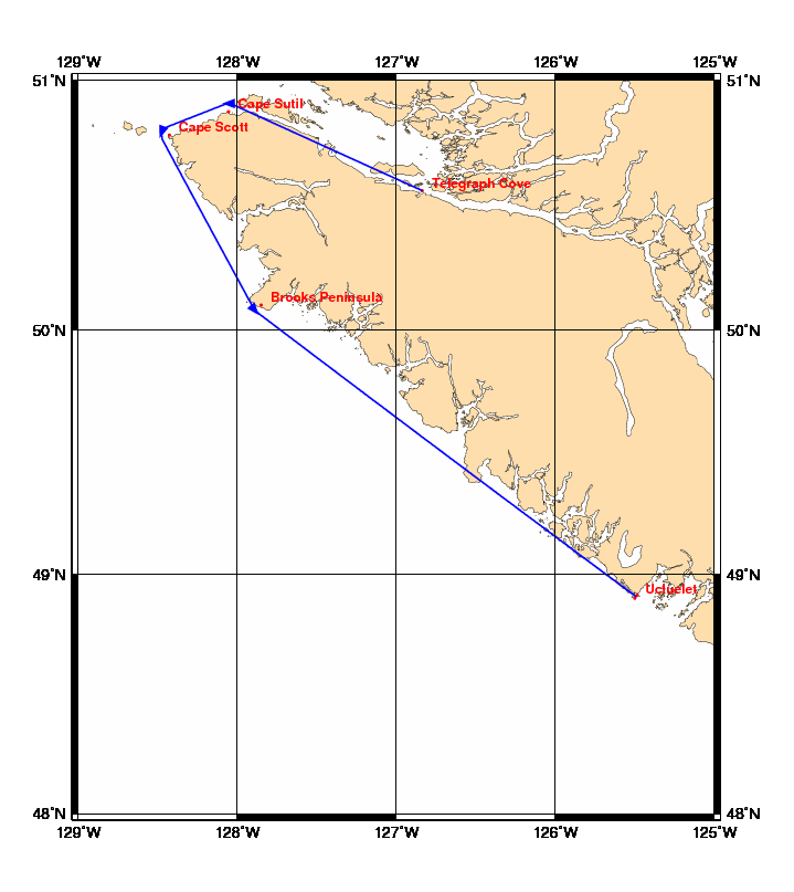
Chart and Info: Vancouver Island 2 (227nm)
Start time: Jun 08 2011 20:00:00 UTC

Start by Telegraph Cove at position: 50N33.5774 126W50.1534

Marks:

BRG is the bearing from ship to mark at scoring position.

 1: Cape Sutil       - Leave 50N52.4640 128W03.2880 to Port - BRG 180
 2: Cape Scott       - Leave 50N46.9200 128W25.5600 to Port - BRG 110
 3: Brooks Peninsula - Leave 50N06.0000 127W51.0000 to Port - BRG 050

Finish line:

Line by Ucluelet between marks A and B at positions:

 A: 48N54.8141 125W29.0542
 B: 48N54.0259 125W29.9857