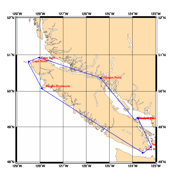
Chart and Info: Around Vancouver Island 2014 (520nm)
Start time: May 30 2014 17:00:00 UTC

Start by Nanaimo at position: 49N12.0000 123W54.0000

Marks:

BRG is the bearing from ship to mark at scoring position.

 1: Chatham Point    - Leave 50N19.9020 125W26.6820 to Port - BRG 213
 2: Cape Sutil       - Leave 50N52.4640 128W03.2880 to Port - BRG 178
 3: Cape Scott       - Leave 50N46.9200 128W25.5600 to Port - BRG 110
 4: Brooks Peninsula - Leave 50N06.0000 127W51.0000 to Port - BRG 047
 5: Race Rocks       - Leave 48N18.7620 123W32.3520 to Port - BRG 357
 6: Ten Mile Point   - Leave 48N27.2400 123W16.2000 to Port - BRG 283
 7: Berry Point      - Leave 49N12.2040 123W49.2240 to Port - BRG 208

Finish line:

Line by Nanaimo Finish between marks A and B at positions:

 A: 49N11.6697 123W52.7078
 B: 49N12.1655 123W52.8017
