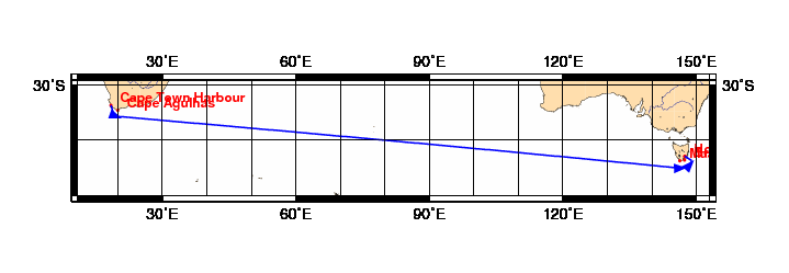
Chart and Info: Cape Town to Hobart 2015 (5445nm)
Start time: Jul 01 2015 10:00:00 UTC

Start by Cape Town Harbour at position: 33S52.9800 018E27.3000

Marks:

BRG is the bearing from ship to mark at scoring position.

 1: Cape Agulhas      - Leave 34S48.0000 020E00.0000 to Port - BRG 020
 2: Maatsuyker Island - Leave 43S39.4440 146E16.2240 to Port - BRG 357
 3: Bruny Island      - Leave 43S30.8400 147E17.7600 to Port - BRG 312

Finish line:

Line by Hobart between marks A and B at positions:

 A: 42S53.9752 147E22.4615
 B: 42S54.0248 147E23.1385